Geo-Application Development: Flight Map
<span>107 words</span><span class="px-2 text-primary-500">·</span><span title="Reading time">1 min</span><span class="px-2 text-primary-500">·</span>
<span class="mb-[2px]">
<a
href="#/Projects/Geo-Application%20Development:%20Flight%20Map/index.md"
class="text-lg hover:text-primary-500"
rel="noopener noreferrer"
target="_blank"
title="Edit content"
><span class="inline-block align-text-bottom">
<span class="relative block icon">
<svg xmlns="http://www.w3.org/2000/svg" height="1em" viewBox="0 0 512 512"><path fill="currentColor" d="M441 58.9L453.1 71c9.4 9.4 9.4 24.6 0 33.9L424 134.1 377.9 88 407 58.9c9.4-9.4 24.6-9.4 33.9 0zM209.8 256.2L344 121.9 390.1 168 255.8 302.2c-2.9 2.9-6.5 5-10.4 6.1l-58.5 16.7 16.7-58.5c1.1-3.9 3.2-7.5 6.1-10.4zM373.1 25L175.8 222.2c-8.7 8.7-15 19.4-18.3 31.1l-28.6 100c-2.4 8.4-.1 17.4 6.1 23.6s15.2 8.5 23.6 6.1l100-28.6c11.8-3.4 22.5-9.7 31.1-18.3L487 138.9c28.1-28.1 28.1-73.7 0-101.8L474.9 25C446.8-3.1 401.2-3.1 373.1 25zM88 64C39.4 64 0 103.4 0 152V424c0 48.6 39.4 88 88 88H360c48.6 0 88-39.4 88-88V312c0-13.3-10.7-24-24-24s-24 10.7-24 24V424c0 22.1-17.9 40-40 40H88c-22.1 0-40-17.9-40-40V152c0-22.1 17.9-40 40-40H200c13.3 0 24-10.7 24-24s-10.7-24-24-24H88z"/></svg>
</span>
</span></a
>
</span>
Table of Contents
Summary #
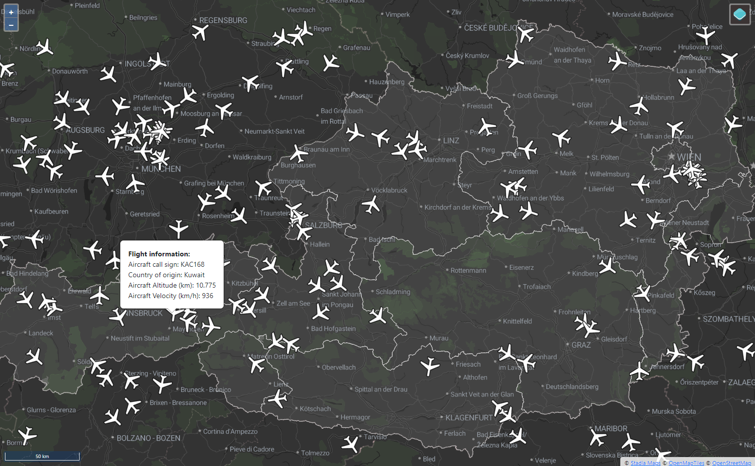
For this project, a live flight-tracking application is developed using HTML, CSS, and JavaScript along with the OpenLayers library. The aircraft information is sourced from the OpenSky Network REST API. Additional data sources are Stadia Maps (basemaps), and Statistik Austria (state borders WFS). The application parses and makes use of sourced data with JavaScript functions. The parsed outputs then serve as input for the OpenLayers map.
A detailed overview of the project including all code, resources, and documentation can be found on GitHub.
AdianDawuda/FlightMap
OpenLayers-based web application to track and visualize live flight data
JavaScript
0
0