Geo-Application Development: Collocated EnMAP Sentinel-5P
Table of Contents
Summary #
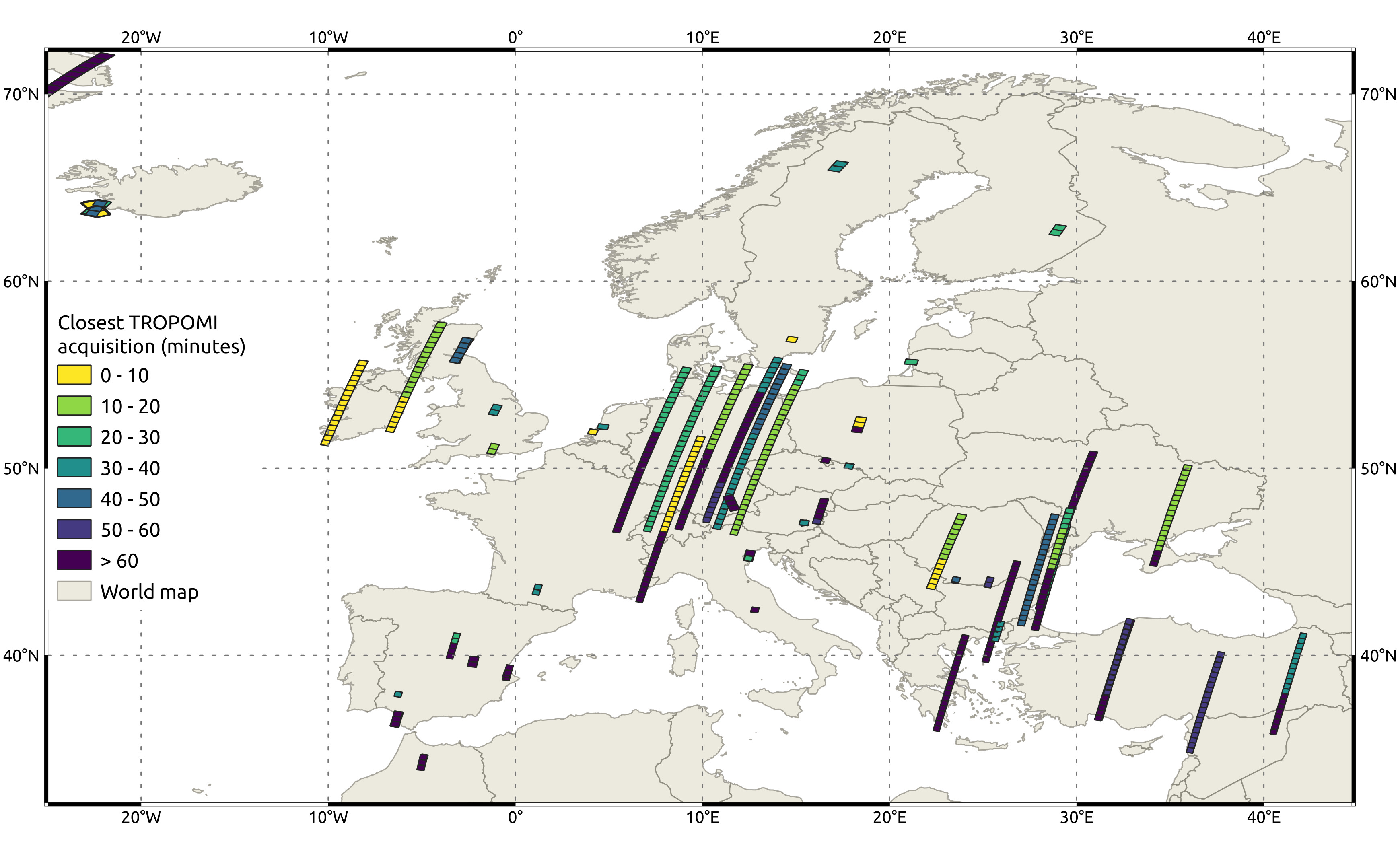
This project supports work conducted for my master’s thesis. The thesis investigates the use of neural networks trained on Sentinel-5P/TROPOMI NO2 slant columns to retrieve atmospheric NO2 concentrations from the EnMAP hyperspectral imager. A necessary step to achieve this is the identification of collocated EnMAP and TROPOMI acquisitions that are used to train a neural network model. The temporal offset between acquisitions should be minimized so that both instruments capture almost the same conditions. The code developed in this project provides a Python workflow to
- identify collocated EnMAP and TROPOMI acquisitions,
- identify the temporal offsets between acquisitions,
- export EnMAP tile geometries and offsets to the temporally closest TROPOMI acquisition as a GeoPackage file,
- and visualize the results usings PyQGIS.
A detailed overview of the project including all code, resources, and documentation can be found on GitHub.
Workflow to identify and visualize collocated EnMAP and temporally closest Sentinel-5P TROPOMI acquisitions